

Sedona Arizona Travel Guide
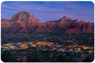
Sedona is a wonderful place to visit. I have gone there three times in the last five years, staying at our Wyndham Timeshare each time. There is a lot to do including Hiking, Wineries (yes even in Arizona), Fun Restaurants, and of course, lots of tourist Shops which are fun to enjoy every now and again...
Sedona Arizona Travel Guide
Here is some helpful information I put together for our recent trip to Sedona! - Trails and Trailhead Information - Wineries - Restaurants - Interesting Places to Visit - State Parks, Monuments, Recreation AreasSedona Trails and Trailhead Planning Table
| Trail | Trailhead Address | Notes |
|---|---|---|
| Soldiers Pass | Soldiers Pass Trailhead – Forest Service Rd 9904, Sedona, AZ 86336 | Tucked inside a residential neighborhood. Lot opens at 8:00 AM. Only 14 parking spots — fills immediately. Arrive 7:30–7:45 AM to line up. No roadside parking allowed (ticketed/towed). No Red Rock Pass required at this specific lot. Restroom available. |
| Fay Canyon | Fay Canyon Trailhead, Boynton Pass Rd, Sedona, AZ 86336 | Large dirt lot directly off Boynton Pass Rd. Red Rock Pass required. Easy access, rarely fills completely. Great beginner hike. No restroom. |
| Robbers Roost | Robbers Roost Trailhead, off Boynton Pass Rd near Fay Canyon | Small roadside dirt pullout. Limited parking (8–10 vehicles). Red Rock Pass required. No facilities. Best in morning for shade and cooler temps. |
| West Fork | Call of the Canyon Day Use Area, 34.9997 N State Route 89A, Sedona, AZ 86336 | Paved lot off Hwy 89A toward Flagstaff (Oak Creek Canyon). Fee area (~$12/day). No Red Rock Pass accepted. Large lot but fills by 9–10 AM on weekends. Restrooms available. Creek crossings — waterproof shoes recommended in winter. |
| Cathedral Rock | Cathedral Rock Trailhead, Back O’ Beyond Rd, Sedona, AZ 86351 | Paved lot. Red Rock Pass required. Extremely popular. Fills early (sunrise best). Overflow parking at Baldwin Trail lot with short connector walk. Restrooms available. Steep scramble near summit. |
| Birthing Cave | Long Canyon Trailhead, Long Canyon Rd (FR 152C), Sedona, AZ 86336 | Dirt road access. Passenger cars usually OK unless muddy. Moderate-size dirt lot. Red Rock Pass required. No facilities. Arrive early; social media popularity makes it busy mid-morning. |
| Keyhole Cave | Sugarloaf Trailhead, 2371 Buena Vista Dr, Sedona, AZ 86336 | Small neighborhood trailhead. Limited parking (10–15 vehicles). Red Rock Pass required. No restroom. Steep, exposed scramble to cave — not marked well. Best done in daylight. |
| Boynton Canyon Subway Cave | Boynton Canyon Trailhead, 625 Boynton Canyon Rd, Sedona, AZ 86336 | Large paved lot near Enchantment Resort entrance. Red Rock Pass required. Fills by mid-morning. Restrooms available. Subway Cave is an unmarked spur trail (~2 miles in). |
| Vultee Arch | Vultee Arch Trailhead, FR 152 (off Dry Creek Rd), Sedona, AZ 86336 | Dirt road access — AWD helpful but many sedans make it. Moderate dirt lot. Red Rock Pass required. No facilities. Less crowded than Devil’s Bridge. |
| Devils Bridge | Dry Creek Vista Trailhead, 1900 Dry Creek Rd, Sedona, AZ 86336 | Large paved lot at Dry Creek Vista. Red Rock Pass required. Road to closer Mescal Trailhead usually closed to passenger cars. Very popular — sunrise or late afternoon best. Restrooms available at Dry Creek lot. |
Sedona Trail Maps & PDF Guides
If you're planning hikes around Sedona, it’s helpful to download PDF trail maps before you go. Cell service can be limited at some trailheads, so having offline maps is highly recommended.
📍 General Trail & Area Maps (PDF Downloads)
-
Sedona Hiking Overview Map (PDF)
https://www.greatsedonahikes.com/hikemapnew.pdf
Broad overview map showing many of the most popular Sedona trail systems. -
Sedona Red Rock Area Map (PDF)
https://www.arizona-dream.com/usa/telecharger/cartes/villes/sedona/sedona-red-rock.pdf
Good general reference map for major formations and trailheads. -
Red Rock State Park Trail Map (PDF)
https://d2umhuunwbec1r.cloudfront.net/gallery/asp-archive/Parks/RERO/downloads/RERO_Park_Map.pdf
Official park map if you plan to explore Red Rock State Park. -
Sedona Urban Trail System Map (PDF)
https://suncorridortrail.org/wp-content/uploads/2020/09/Sedona-Urban-trail-system.pdf
Shows city connector paths and access points between trailheads. -
Sedona Shuttle Rider Guide & Trailhead Map (PDF)
https://sedonashuttle.com/wp-content/uploads/2025/07/Sedona-Rider-Guide-summer-2025-Safe-Schedule.pdf
Includes shuttle routes to popular trailheads like Soldier Pass, Cathedral Rock, and Devil’s Bridge.
📘 Trail Guide (Preview PDF)
-
Day Hikes Around Sedona – Sample Guide (PDF Preview)
https://api.pageplace.de/preview/DT0400.9781573422123_A24509583/preview-9781573422123_A24509583.pdf
Classic hiking guide covering West Fork, Vultee Arch, Boynton Canyon, and more.
🗺️ Planning Tips
- Download and save PDFs before your trip — some trailheads have weak cell reception.
- Most trailheads require a Red Rock Pass (West Fork is a separate paid day-use area).
- Arrive early for popular hikes like Devil’s Bridge, Cathedral Rock, and Soldier Pass.
- Layer clothing in February — mornings can be cold and afternoons mild.
Have a great Sedona hiking adventure!